House Clearance In Northumberland
Prudhoe Morpeth Blyth Ashington Alnwick Hexham Corbridge Haydon Bridge Haltwhistle Rothbury Otterburn Brampton Alnmouth Amble Bamburgh Belford Wooler House clearance Berwick/upon/Tweed House clearance Coldstream Kielder Darras Hall Matfen Saltwick Meldon Longwitton Holystone
House Clearance Service
Do You Need A Fully Licensed & Insured House Clearance Service?
![]() Fully insured to undertake Property Clearance
Fully insured to undertake Property Clearance
![]() Fully licensed to undertake Property Clearance
Fully licensed to undertake Property Clearance
![]() Registered with the Environment Agency
Registered with the Environment Agency
![]() Fully trained, professional staff
Fully trained, professional staff
![]() Environmentally friendly service
Environmentally friendly service
![]() Discreet service
Discreet service
 We specialise in House Clearance throughout Northern England & Scotland.
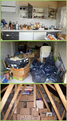
1st Call Northern House Clearance Co. is a family business with well over 30 years experience clearing houses. We clear houses, garages, sheds, loft spaces & more.
Read Our House Clearance Customers Comments
Prudhoe Information
- Latitude and Longitude: 54°57’0″ N, 1°51’0″ W
- or in decimal: 54.9500, /1.8500
- Est. Population: 10,669
- Average Elevation: 134m above sea level
- Country: England
- Postcode Area: North East42
- County/District: Northumberland
Local Transport Links
- Prudhoe Rail Station / 1 Kilometer North West
- Wylam Rail Station / Two Kilometers North East
- Stocksfield Rail Station / Three Kilometers W
- Riding Mill Rail Station / Five Kilometers W
- Blaydon Rail Station / Six Kilometers E
- Corbridge Rail Station / Seven Kilometers W
- MetroCentre Rail Station / Seven Kilometers E
- Dunston Rail Station / Eight Kilometers E
Closest Airfields to Prudhoe
- Newcastle International Airfield / Nine Kilometers North East
- Boulmer / Four Kilometers N
- Tees/Side / 3Five Kilometers South East
- Leeming / Seven Kilometers S
Nearby Points of Interest
- Prudhoe Castle Keep / 1 Kilometer N
- Nafferton Castle Keep / Three Kilometers North West
- Bywell Castle Keep / Three Kilometers W
- Rudchester Hall / Four Kilometers N
- Newton Hall Tower / Four Kilometers North West
- Welton Hall / Four Kilometers North West
- Newburn Hall / Five Kilometers North East
- Styford Motte (Castle Keep) / Five Kilometers W
- Stamfordham Vicars Tower / Six Kilometers N
- Aydon Castle Keep / Seven Kilometers North West
- Corbridge Low Hall / Seven Kilometers W
- Corbridge Vicars Pele / Seven Kilometers W
- Hole Row Tower / Seven Kilometers S
- Benwell Towers / Seven Kilometers E
- Fenwick Tower / Seven Kilometers N
- Dilston Castle Keep / Eight Kilometers W
- Stagshaw High Farm / Eight Kilometers North West
- Ponteland Tower / Eight Kilometers North East
- Ponteland Castle Keep / Eight Kilometers North East
- Elswick / Eight Kilometers E
- Nuns Moor (Park) / Nine Kilometers North East
- Beaufront Castle Keep / Nine Kilometers W
- Blackheddon Farmhouse (Castle Keep) / Nine Kilometers N
- Pockerley Pele / Nine Kilometers South East
- Thorn Tower / Nine Kilometers N
Nearby Geographical Features
- Bent Hill / Ten Kilometers North East
- Collier Law (Hill) / Three Kilometers S
